Monterey Maps and Orientation
(Monterey, California - CA, USA)
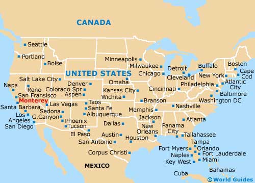
Just north of central California, the state's western coast is where much of the appeal lies for tourists, away from
Los Angeles and
San Diego in the south. Monterey may just be a small city, but it is the perfect base for excursions.
Carmel by the Sea is especially close, while roughly an hour and a half away is
San Jose to the north. Further north is
San Francisco, which is still quite reachable (via the CA-1 / Cabrillo Highway and US-101) and is ideal for a weekend break or longer.
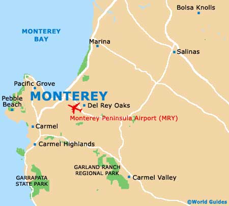
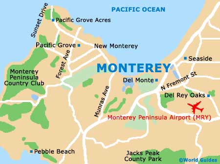
In the city itself, various attractions present themselves. Standing alongside the bayfront, highlights include the Monterey State Beach, the Monterey Bay Aquarium, the American Tin Cannery Factory Outlets, Berwick Park, the Pacific Grove Marine Gardens Park, the Pacific Grove Golf Links, the Asilomar State Beach and the Cypress Point Golf Course.
Maps and Orientation of the City
Located on the corner of the Camino El Estero and East Franklin Street, the Monterey County Visitors Center is a good place to pick up maps, being found right next to El Estero Park and close to the El Estero Presbyterian Church.
Take a stroll to the north and you will soon reach the Monterey Bay Coastal Trail, the Municipal Beach and the Municipal Wharf 2, where a cluster of seaside eateries are based.
- Big Sur - 29 miles / 47 km (40 minutes, south)
- Carmel by the Sea - 4 miles / 6 km (ten minutes, south)
- Garrapata State Park - 11 miles / 18 km (20 minutes, south)
- Gonzales - 36 miles / 58 km (55 minutes, southeast)
- Napa Valley - 150 miles / 241 km (three hours and 15 minutes, north)
- Oakland - 111 miles / 179 km (two hours and 20 minutes, north)
- Point Lobos State Reserve - 8 miles / 13 km (15 minutes, south)
- Rio Del Mar - 34 miles / 55 km (50 minutes, north)
- Sacramento - 186 miles / 299 km (three hours and 45 minutes, north)
- Salinas - 20 miles / 32 km (30 minutes, northeast)
- San Francisco - 112 miles / 180 km (two hours and 20 minutes, north)
- San Jose - 70 miles / 113 km (one hour and 35 minutes, north)
- Santa Cruz - 42 miles / 68 km (one hour and ten minutes, north)
- Soledad - 46 miles / 74 km (one hour and 15 minutes, southeast)
- Watsonville - 27 miles / 43 km (40 minutes, north)
Map of the United States
Map of California

Map of Monterey